Показват се публикациите с етикет Rock climbing. Показване на всички публикации

2008/11/07

Europe, Greece, Thessalia - Meteora

There is an area called Thessalia, in the heart of Greece, in which one of the most well-known and best climbing areas of Greece is situated. It is called Meteora, which translated means: the ones that stand, hang alone in the air. The first people who climbed these rocks were shepherds who carried their sheep up to the top to graze to ensure their survival.

The first routes to be climbed were the cracks and chimneys similar to those climbed in the area of Saxony in East Germany. As is the custom a small notebook was left in a metal box on the top of every peak. What is amazing is that on some infrequently climbed towers you can still find the notebooks dating back to the seventies and read the notes of the first climbers. On the first page the major routes of the pillar are denoted, as are the ways to descend (rappels) followed by the names of all those who have reached the top up to the present day.

The type of rock is unique and quite different from other climbing areas of Greece. The rock is mainly pebbles, stones, gravel and frail sandstone.

The ideal weather conditions of Greece permit climbing starting from the spring, late April to middle of June and after the hot Greek summer from September till the end of November. Generally speaking, climbing is possible throughout the whole year.

Climbing in Meteora never ends. There is an unlimited selection of routes. Get yourself familiar with the rock and the way of climbing it, after carefully studying & consulting the climbing guides. Every route has its own beauty and worth.

Some of the most beautiful routes, with many repetitions and in classic style, as given by the Hasse & Stutte guides are the following:
One of the classic routes is in the Holy Ghost «The pillar of Dreams » V+ 250 m. On the Sourloti rock «Hypotenuse» VI 225 meters and « The line of fallen drop» VI 170 meters. On Kelch tower «The eggs dance - Eiertanz» VI- A1 130 meters with the fantastic and breathtaking step across and in Alyssos the " Community Route" VI A2 320M.
On the tower of Bell "Glockenspiel" VI 125m, in Bantova rock "Swiss cheese" VII - and in Doupiani rock " Ostkante VI 125 m. & "Dickes Ende" VII- 145m.
An amazing and well known corner (pictures 20,30,40) is in Holy Ghost «The corner of Madness » VII 180 meters and in the Caucasian tower a classic route "Roussanou End" V+ 160.
If you prefer a little bit of everything (cracks, traverse, steep) go to The Tower of Meteora, at the "DOHLEWAND DIRECT" VI- 145 m route.

Last but not least - It is forbidden to climb to the towers on which Monasteries exist! There are no routes! This was what Dietrich Hasse and his team agreed together with the church authorities back in the 70's and this still applies today.


The map of the area.

Used information and pictures from http://www.planetmountain.com/ and http://picasaweb.google.com/

2008/10/16

North America, USA, California - Yosemite National Park

Yosemite National Park is located in the eastern portions of Tuolumne, Mariposa and Madera counties in east central California. The park covers an area of 3 081 km² and reaches across the western slopes of the Sierra Nevada mountain chain. Yosemite is visited by over 3.5 million people each year. Designated a World Heritage Site in 1984, Yosemite is internationally recognized for its spectacular granite cliffs, waterfalls, clear streams, Giant Sequoia groves, and biological diversity.

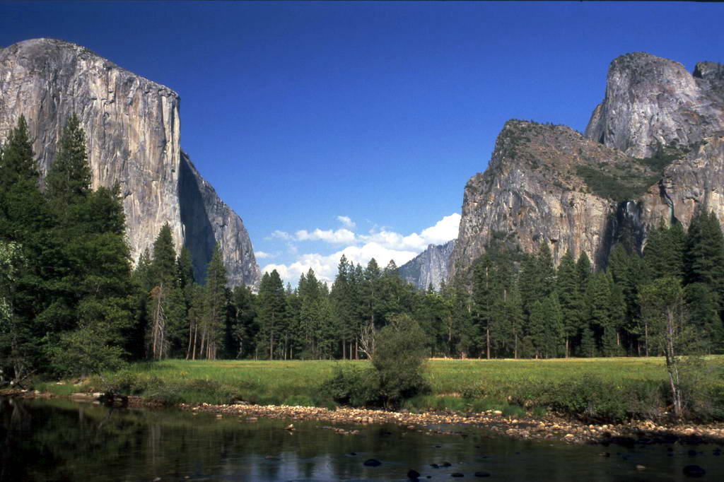
Yosemite Valley represents only one percent of the park area, but this is where most visitors arrive and stay. El Capitan, a prominent granite cliff that looms over the valley, is one of the most popular rock climbing destinations in the world because of its diverse range of climbing routes in addition to its year-round accessibility. Granite domes such as Sentinel Rock and Half Dome rise 900 and 1,450 m above the valley floor. Complete list of Yosemite's Best Free Climbing Routes could be found here.

El Capitan is a 910 m vertical rock formation, located on the north side of Yosemite Valley, near its western end. The granite monolith is one of the world's favorite challenges for rock climbers.

The formation was named "El Capitan" by the Mariposa Battalion when it explored the valley in 1851. El Capitan ("the captain", "the chief") was taken to be a loose Spanish translation of the local Native American name for the cliff, variously transcribed as "To-to-kon oo-lah" or "To-tock-ah-noo-lah". It is unclear if the Native American name referred to a specific Tribal chief, or simply meant "the chief" or "rock chief". In modern times, the formation's name is often contracted to "El Cap", especially among rock climbers.

El Capitan, or El Cap, has two faces: the Southwest and the Southeast. Between the two faces is a protruding shelf called The Nose. The Nose is the most popular and famous route by which to climb El Capitan. The Nose was first climbed in 1958 by Warren J. Harding, Wayne Marry, and George Whitmore in 47 days. They used “siege” tactics, which meant using fixed ropes along the length of the route and establishing camps. The second ascent in 1960 took 7 days. The first single day ascent was accomplished in 1975. Presently, The Nose challenges climbers of all experience levels. Some of the earliest routes for climbing El Capitan are still the favorites; Salathe Wall on the southwest face, and the North America Wall on the southeast face, both climbed in the 60s. Other early routes include Dihedral Wall, West Buttress, and Muir Wall. Later climbs involve routes like the Wall of Early Morning Light, Zodiac, Mescalito, the Sea of Dreams, the Shield, the Pacific Ocean Wall, and the Jolly Roger. Today there are over 70 routes going up El Capitan, many of which link old routes and new ones. With that many routes, there is something to appeal to every level of experience and ability.


Climbing the Nose in June 2007 - Konrad Schlenkrich & Livio Urban & Thomas Johne (Germany)


Ascent of Zodiac (VI, 5.8, A3) on Yosemite's El Capitan.

Half Dome is a granite dome, located at the eastern end of Yosemite Valley — possibly Yosemite's most familiar sight. The granite crest rises more than 1 444 m above the valley floor.

As late as the 1870s, Half Dome was declared "perfectly inaccessible", but it may now be ascended in several different ways. Thousands of hikers reach the top each year by following a trail from the valley floor. The trailhead is only 3.2 km from Half Dome itself, but the circuitous route is 13.7 km long. The final ascent is accomplished by following a pair of metal cables raised on posts up the peak's steep but somewhat rounded east face. The cable route was constructed in 1919, but followed close to the route of George Anderson's October, 1875 first ascent made by drilling iron eyebolts into the smooth granite.

Alternatively, over a dozen rock climbing routes lead from the valley up Half Dome's vertical northwest face. Other routes ascend the south face and the west shoulder. The first modern technical route was the Regular Northwest Face route - originally climbed in 1957 by Royal Robbins, Mike Sherrick, and Jerry Gallwas. This 5-day ascent was the first Grade VI climb in the United States.


VIDEO-HIKE part of the Half Dome trail.

Used information, pictures and video from http://en.wikipedia.org/, http://www.extranomical.com/ and http://www.youtube.com/

2008/10/10

North America, USA, California - Joshua Tree National Park

I learned about Joshua Tree National Park from my mate, Sonja. Later she got engaged there and that made this place one of my favorites in the US . It is located in southeastern California . Declared a U.S. National Park in 1994, it had previously been a U.S. National Monument since 1936. It includes over 3 196 km² of land. The park includes parts of two deserts, each an ecosystem whose characteristics are determined primarily by elevation. Below 900 m, the Colorado Desert encompasses the eastern part of the park and features natural gardens of creosote bush, ocotillo, and cholla cactus. The Little San Bernardino Mountains run through the southwest edge of the park.
The higher, moister, and slightly cooler Mojave Desert is the special habitat of the Joshua tree (Yucca brevifolia), from which the park gets its name. The dominant geologic features of the landscape are hills of bare rock, usually broken up into loose boulders. These hills are popular among rock climbing and scrambling enthusiasts. The flatland between these hills is sparsely forested with Joshua trees. Together with the boulder piles and Skull Rock, the trees make the landscape otherworldly. An interesting fact about Joshua Tree National Park is that five of North America 's 158 desert fan palm oases are located there.
Joshua Tree attract climbers and bouldering enthusiasts from around the world with more than 400 climbing formations and 8,000 climbing routes. This climbing mecca is famous for its traditional-style crack, slab, and steep-face climbing.
Maps of the major climbing areas could be found here.


Used information, pictures and video from http://en.wikipedia.org/, http://www.nps.gov/jotr/ and http://www.youtube.com/

2008/09/20

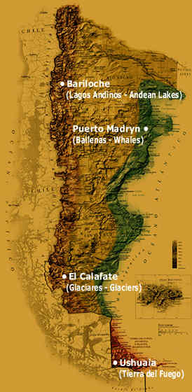
South America, Argentina - Patagonia

Patagonia is a geographic region containing the southernmost portion of South America. Mostly located in Argentina and partly in Chile, it comprises the Andes mountains to the west and south, and plateau and low plains to the east. The name Patagonia comes from the word patagon used by Magellan to describe the native people who his expedition thought to be giants. It is now believed the Patagons were actually Tehuelches with an average height of 1.80 m compared to the 1.55 m average for Spaniards of the time.

To the east of the Andes, it lies south of the Neuquén River and Colorado rivers, and, to the west of the Andes, south of 39°S, excluding the Chiloé Archipelago. East of the Andes the Argentine portion of Patagonia includes the provinces of Neuquén, Río Negro, Chubut, Santa Cruz, and Tierra del Fuego, as well as the southern tips of the provinces of Buenos Aires, Mendoza and La Pampa. The Chilean portion embraces the southern part of the region of Los Lagos, and the regions of Aisén and Magallanes. It excludes those portions of Antarctica claimed by both countries.


Chilean Patagonia - Torres del Paine /uploaded in YouTube by tlapse/


Patagonia National Park /uploaded in YouTube by patagoniavideo/

Patagonia attract tourists with the amazing nature and spectacular views. It's a place where the land, ocean and the sky are cross.

Here is located the most famous rock needle in the world - Cerro Torre. It's famous not for its height but rather its foul weather, its very long pointed shape and difficult technical climbs. Because the Patagonian Ice Cap is located near it Pacific storms are lifted and focused through a geographic effect that drops lots of precipitation and adds power to the winds making them fearsome. Even the toughest of climbers have to take a hard long look deep inside before climbing in the conditions that Cerro Torre can dish out. Climbs usually take three to eight days however it has been climbed in a day and a half. The weather on Cerro Torre is very bad with the 7000 foot south face seeming to have the worst weather. Often the top of Cerro Torre is covered in a crown of rime ice and some climbers have been known to call it a day just below this crown because of the difficulty of climbing the often over hanging ice.
Take a look at this video.

Patagonia - Cerro Torre /uploaded in YouTube by esalvaterra/

Used videos and information from http://en.wikipedia.org/, http://www.summitpost.org/ and http://www.youtube.com/

2008/08/31

Europe, Italy - Dolomites

The Dolomites are a challenging and beautiful range of steep limestone peaks situated south of the Austrian/Italian border. The area is stretching out 80 kilometers east of Bolzano, which is split into different groups linked by a good road network. Many of the peaks are over 3000 meters high, giving long and demanding big wall routes up to 800 meters long. Some routes can be over 20-pitches long, however most them can be done in a single days outing or with an overnight stay in a mountain hut or lodge.

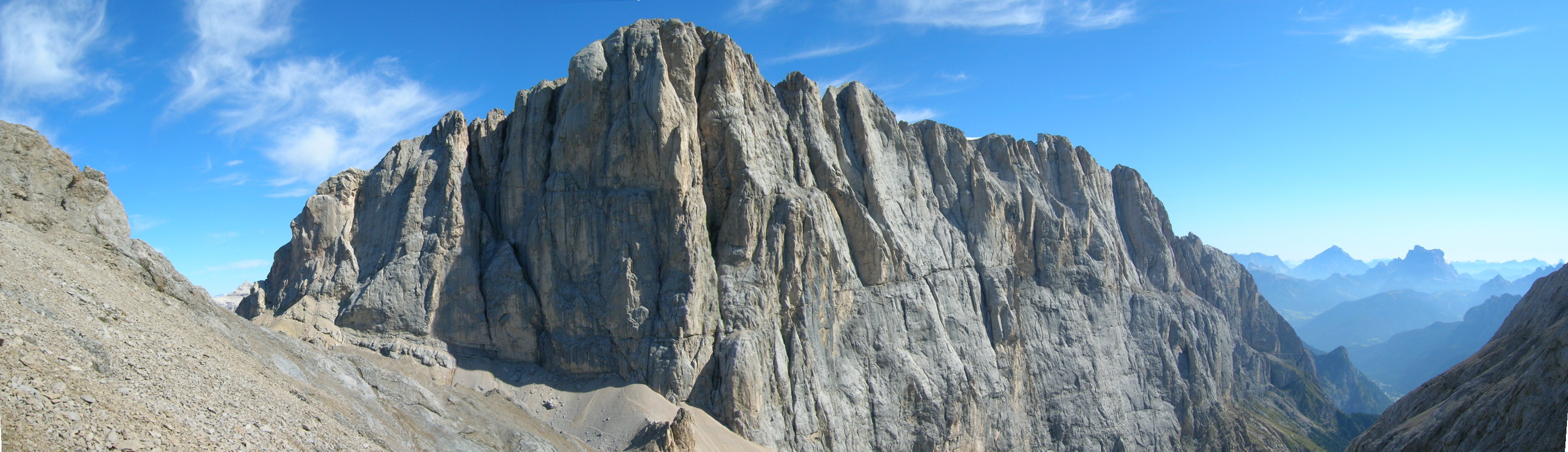
The highest mountain in the Dolomites is Marmolada, with its impressive 800 meters high and 3kilometers wide south facing limestone wall. All of the routes on this face are long and serious, and unique to the Dolomites, may take longer than a day to complete. It is wise to pack a bivouac bag. Unless you catch the expensive last cable car from the summit then the descent is down the north side of the mountain, which has the only glacier in the region! It is therefore recommended that in-step crampons and lightweight boots be worn.

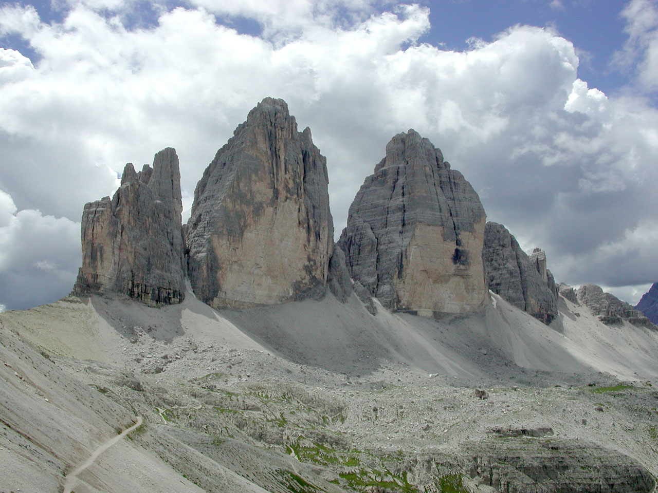
The north face of Cima Grande is one of the great alpine north faces and is breathtakingly steep - a real big wall. At 450 meters and 16-pitches long, and graded at UIAA V11- (UK E2 5c or French 6b) it is very sustained for long periods and therefore demands the prestige attached to it. However as with many of the routes in the Dolomites it is possible to aid across the difficult sections, which reduces this route to V1/A1 (UK E1 5B or French 6a).

The Sella Towers and Piz Ciavazes have a reputation for short approaches, easy descents, and well-protected routes that are not too long. However just on the other side of the Sella Pass is the Sassolungo area, where the routes are a much more serious undertaking and have an "alpine" experience about them.
Between Cortina and St Kassian is the Falzarego Pass, which offers some of the best rock climbing in the Dolomites. There are plenty of south-facing mid-grade routes; with short easy approaches; uncomplicated descents; and solid, well-protected routes.

Used pictures and information from http://en.wikipedia.org/, http://www.climb-europe.com/ and http://commons.wikimedia.org/

2008/08/11

Europe, Balkans, Greece - Kalymnos

My best friend Sonja and her boyfriend (now husband) Mike were my guests almost two years ago. During their visit I learned for an amazing place very close to Bulgaria - Kalymnos. They showed me a book with wonderful picture of this climbing paradise and make me dream about it.

The island of Kalymnos is about 300 kilometers south east of Athens, and 100 kilometers north west of Rhodes. It has 15 500 permanent inhabitants, most of whom live in Pothia, the capital of the island. It is well known as the sponge harvester’s island. It is surrounded by a number of small islands, only two of which are inhabited, Pserimos and Telendos. Pothia is a picturesque town built like an amphitheatre around the port. It has all the necessary facilities such as banks, a post office, a hospital etc, as well as an intense commercial life with shops selling all kinds of goods.

The island of Kalymnos offers rock climbing throughout the whole year although summer can be very hot and the winter weather is a little unpredictable. April and May are usually considered to be the best time for rock climbing and bouldering.
Rock climbing on Kalymnos started as recent at 1996 when Italian climbers discovered Kalymnos as a climber’s paradise. The island offers a variety of numerous lime stone rocks with different kinds of difficult degrees. The rock climbing is never monotonous as there are routes involving delicate moves or athletic routes on overhangs and roofs with holes and stalagmites.
Rock climbing on Kalymnos is still rather unknown at an international level and therefore you will not find the usual crowds and queues which are typical on the famous crags.
There are 24 equipped crags with 200 pitches , from F4c to F8a+ (all bolt protected, sport climbing), mostly facing west , but a few facing south .
The rock is excellent quality limestone, sharp at only a few points, without vegetation, and the pitches are equipped with rustproof bolts. At the moment almost all the routes are one pitch, but there are many possibilities for amazing two to five pitch routes. Indeed, apart from the quality, there is also the vast amount of rock available. The opened routes represent not more than 5% of the possibilities, while there are several equally good cliffs completely untouched that are awaiting their first route!
The ranking system in use is the French one. The grades of these routes are on the Kalymnos Route Database.

Used pictures and information from http://www.kalymnosinfo.com/ and http://www.kalymnos-isl.gr/